Create KML delivery zones
A KML file defines the exact geographic shape of a delivery area, so you can control coverage precisely instead of relying on a simple radius. This guide walks through creating a KML file with Google Earth, a free, fast tool for drawing delivery boundaries, and uploading it to your store settings in the Dashboard.
Why use KML delivery zones
- Precise coverage control — define exact delivery boundaries instead of an approximate radius, so orders outside your real coverage area are rejected before they're placed.
- Improved logistics — drivers and dispatchers work within clear, predefined areas.
- Customizable zones — create multiple delivery regions based on store capacity or demand.
- Easy integration — upload the KML file directly to your store settings in Ordering.co.
- Scalable setup — works for a single-location store or a multi-zone delivery network.
Create a KML file in Google Earth
-
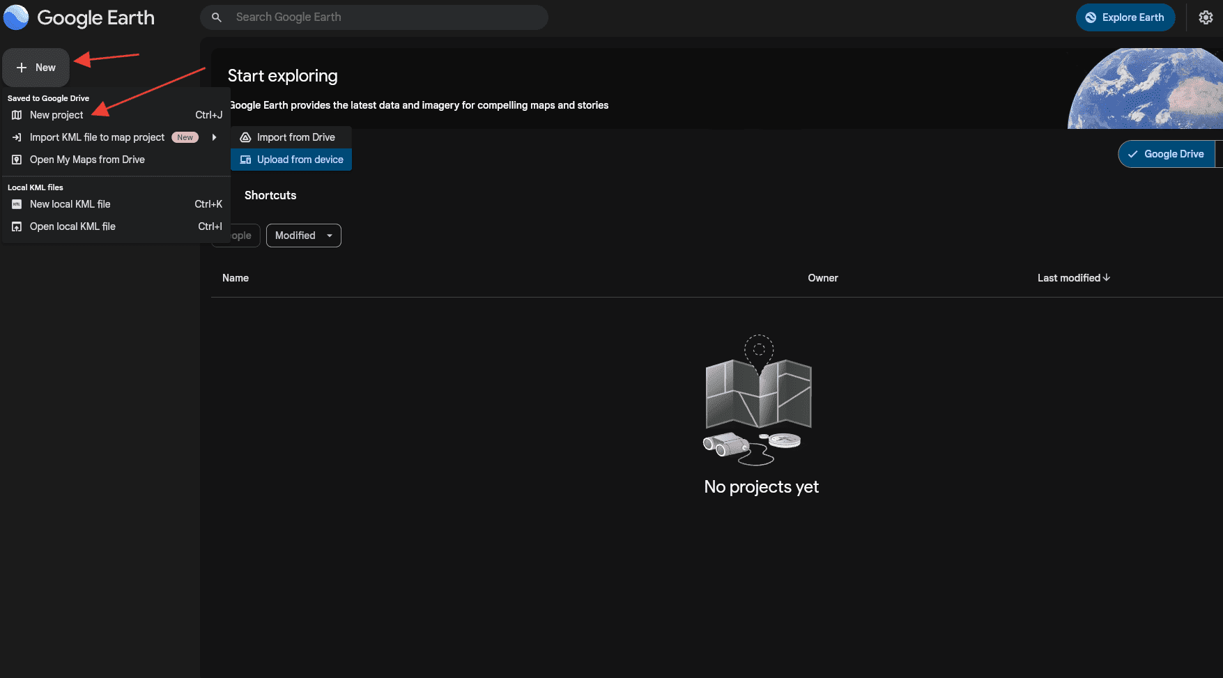
Open Google Earth, create a new project, and select New Project.
-
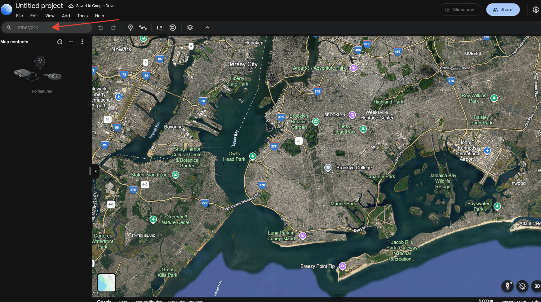
Search for your city to center the map on your delivery area.
-
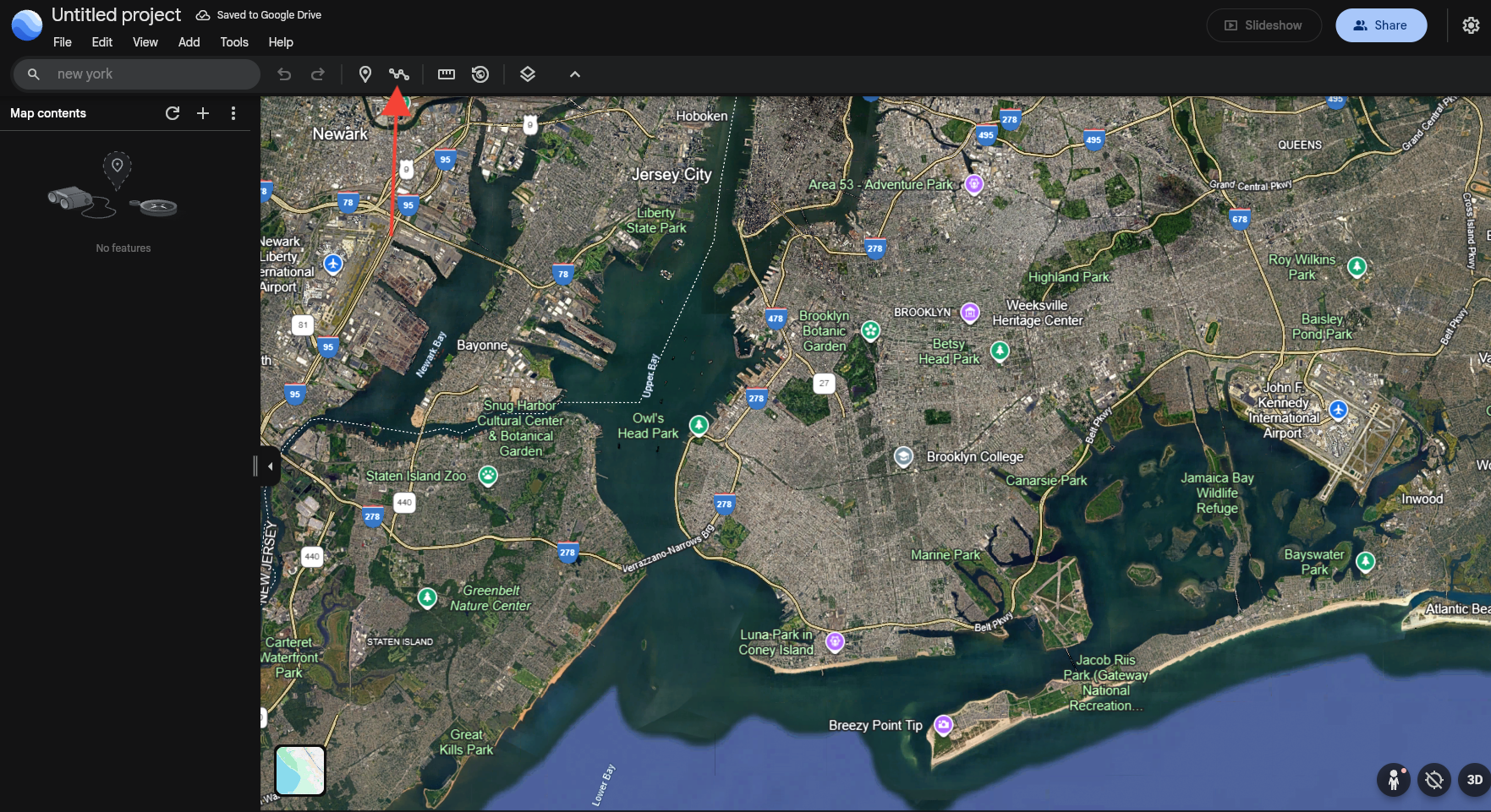
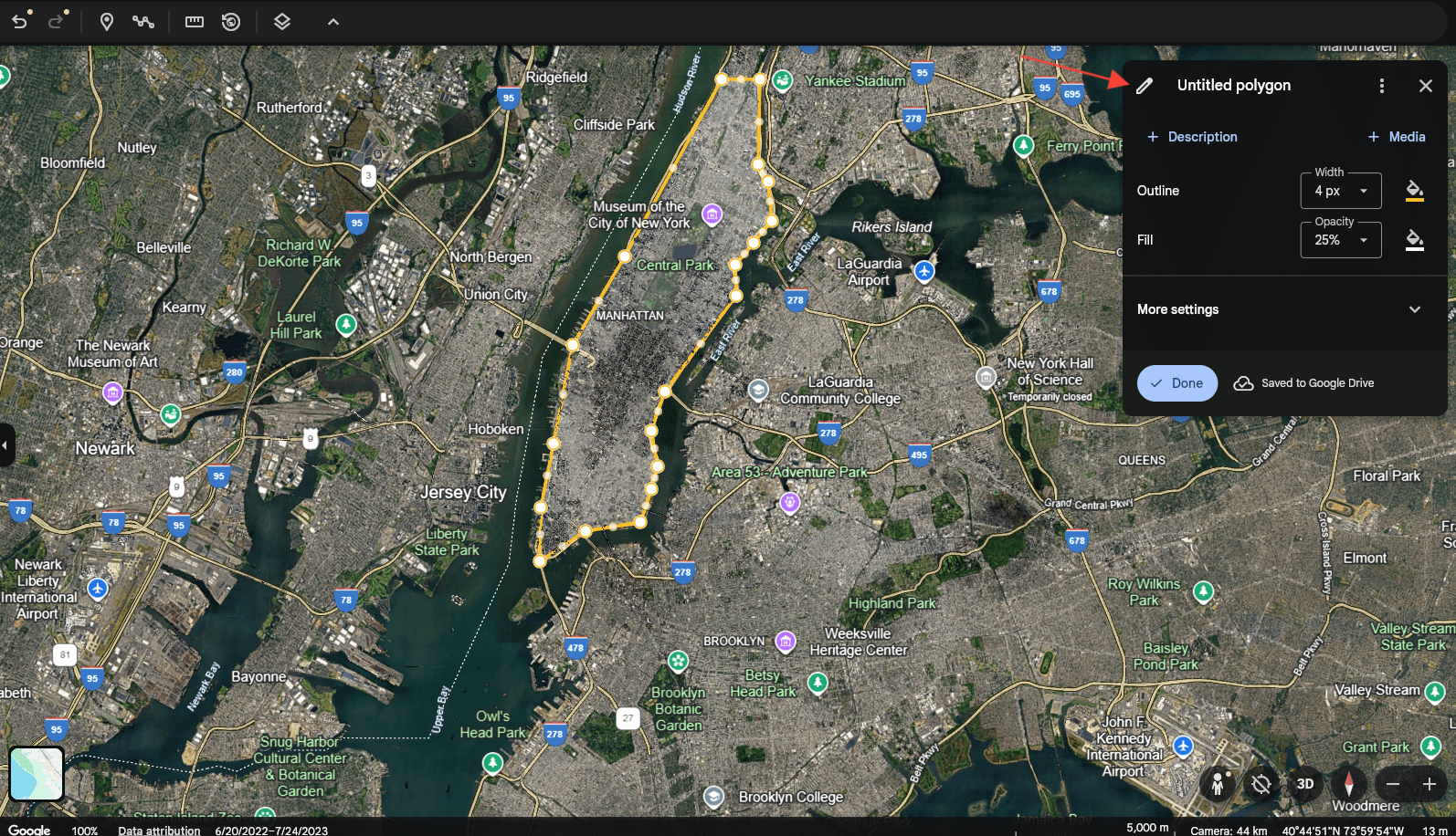
Select Add path or polygon to start drawing the area you want to cover.
-
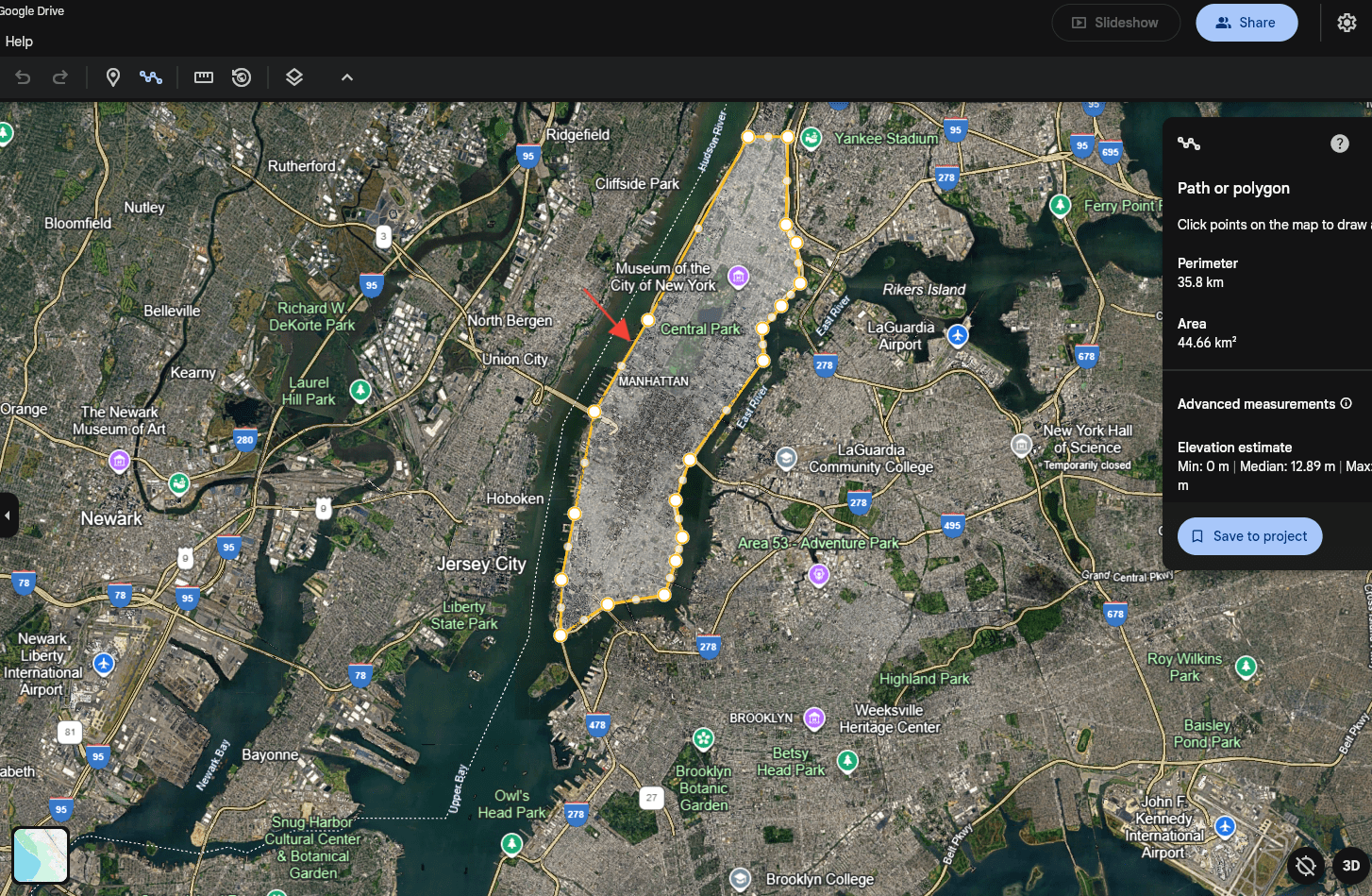
Draw the delivery area. The polygon or path must always be a closed shape — leaving it open causes problems when the file is imported. When you're done, select Save to Project.
-
Give the project a clear name so you can find and assign it to the right store later.
-
Select the three-dot menu next to the project in the left panel and choose Export as KML file.
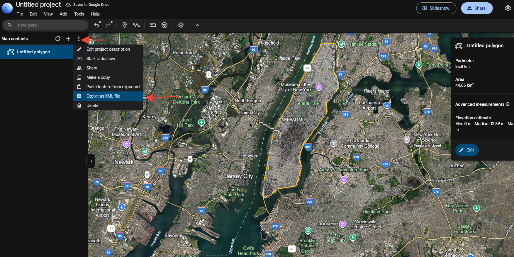
Your KML file is ready to use.
Apply the KML boundary to your store
A store's delivery-zone editor in the Dashboard defines zones with the Polygon method among others — see Delivery and pickup for the full set of methods. Use your exported KML file as the reference for the exact boundary: open it in Google Earth (or any KML viewer) alongside the Dashboard's delivery-zone map and reproduce the same points with the Polygon tool to activate location-based delivery for that area.
Use cases
- Urban delivery zones — define neighborhoods or districts for efficient routing.
- Multi-store networks — assign a different KML zone to each store location.
- Dynamic coverage — adjust delivery areas as demand or operations change, by re-exporting and re-uploading an updated KML file.